SaTxWx
CLOSE MENU
X
Dashboard Admin
Indoor Data
Forecast
Local Airport
Sun | Moon Info
Regional Earthquakes
Hardware Info
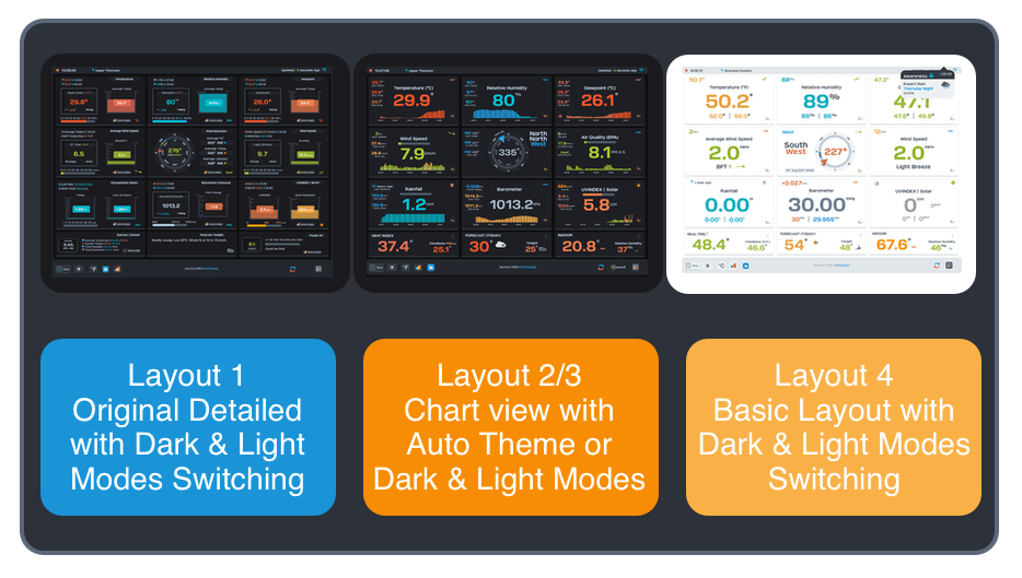
Dashboard Layouts
1
2
3
4
5
6
UNITS
Available Units
°F
°C
UK
KTS
M/S
Menu
°F
Aurora MKII (
Meteostick-Vantage
)